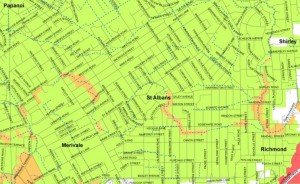
The landreports released by the government today show most of St Albans to be classified green, with very few patches in orange – meaning those property are still in ‘limbo’.
The full press release by the Beehive explains the details of the different zones. Factsheets and a map can be downloaded from the official website as well.
Anyone who likes to look up his or her property or his or her street can go to a specific website at http://www.landcheck.org.nz

